March 2024 Summary
Summary
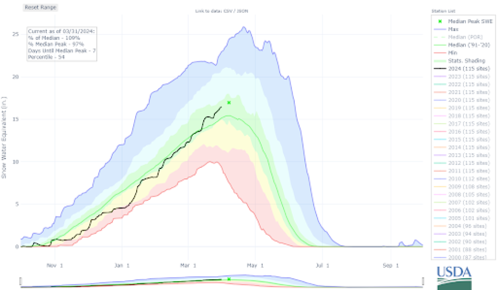
March was a snowy month for Colorado. February increased the statewide Snow Water Equivalent (SWE) close to 30-year median values, and then March pushed our snowpack to above median values. Although snowfall was consistent, there were three particularly snowy periods: March 2 to 8, March 12 to 16, and March 23 to the end of the month. The consistent snowfall generally helped build a deeper and stronger snowpack although the Elk Mountains and some portions of the Sawatch Range continued to see very large avalanches into the end of March.
Despite the snowy weather, there were about 20% fewer reported avalanches in March than in February. However, more backcountry users were caught in avalanches this month than any other month this year.
- 935 avalanches recorded across the state ( 24% less than February)
- 334 avalanches size D2 or larger (40% less than February)
- 20 avalanches size D3 or D3.5
- 194 human-triggered avalanches
- 33 avalanche incidents and accidents (44% more than February)
Thankfully we escaped March without a fatal avalanche accident despite some very close calls. This is the first March without a fatality since March of 2020, but without two amazing companion rescue efforts, this summary would be more somber.
Early March
At the start of the month, the main concern across most of the state was a weak layer of surface hoar and near-surface facets that was buried in early February. We saw numerous avalanches break on this layer throughout February and into March. With consistent snowfall in the first part of March, this layer was buried so deep that it became harder to affect, and snowpack stability generally improved.
March 12-16 Storm
A significant upslope storm for the eastern mountains began on March 12, burying the Front Range and many areas east of the Continental Divide with up to four feet of snow. Although this storm was not as historic as the blizzard of March 2003, it was one of the most significant upslope storms in the last 20 years. In the areas that got close to four feet of snow, there wasn’t a pre-existing snowpack or buried weak layers to worry about. So while we saw avalanches, avalanche activity wasn’t anything to write home about. The most unusual activity was avalanches occurring at lower elevations of Teller County and around Pikes Peak.
Following this storm, there was a brief break in snowfall. This dry weather led to the faceting of the snow surface.
Late March and New Persistent Weak Layer
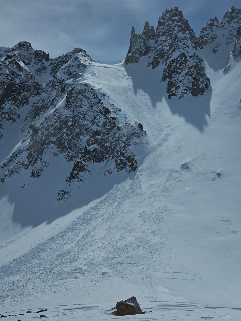
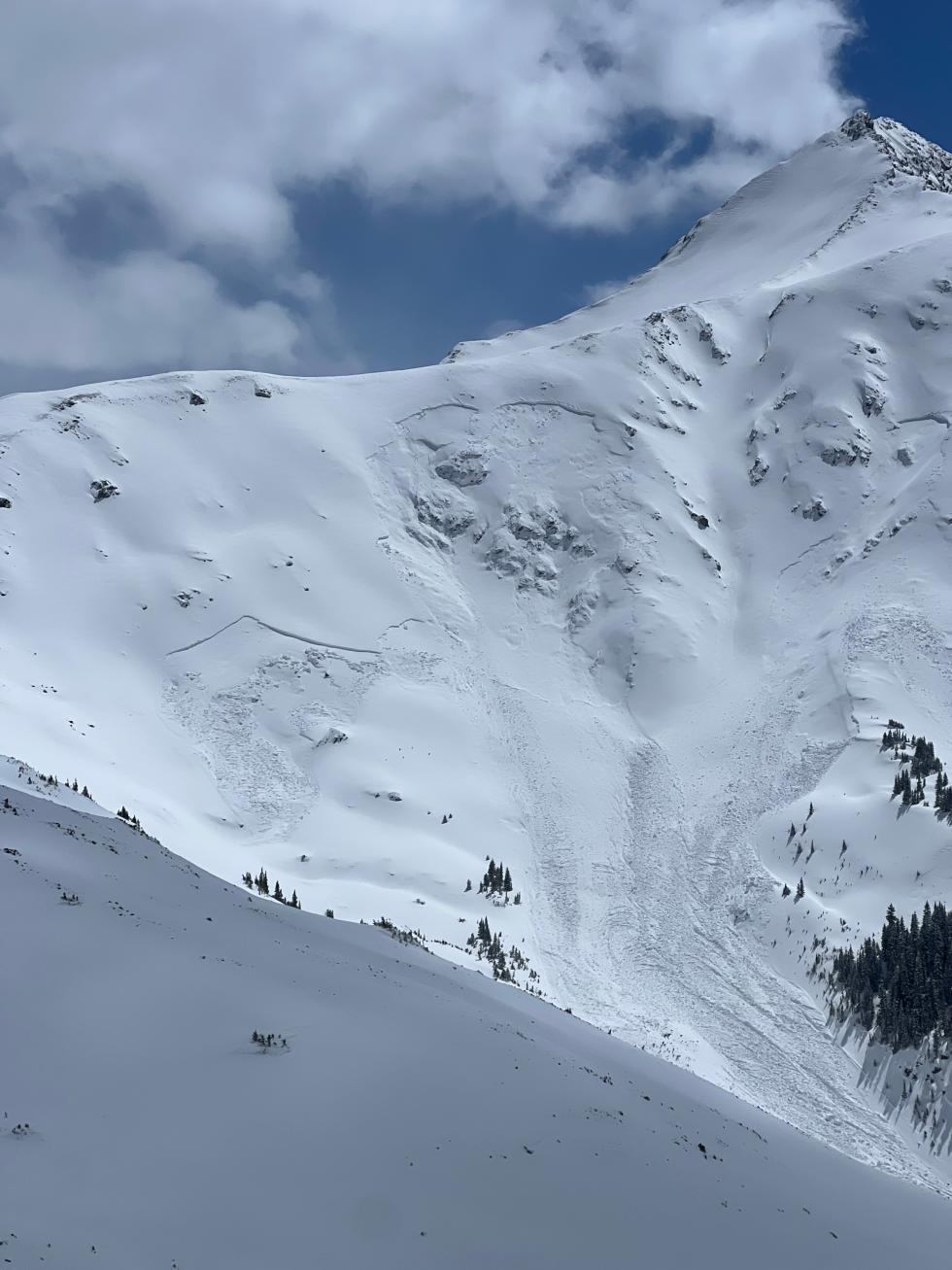
The last stormy period of the month was notable from a seasonal perspective as it buried the new weak layer that developed during the dry weather. The most troublesome spots were in the West Elk and Elk Mountains where the most snow fell (2 to 4 feet) since March 23. These mountains ended the month with HIGH (Level 4 of 5) danger, a Special Avalanche Advisory, and a new Persistent Slab avalanche problem. Some of the biggest avalanches of the season occurred at the end of March around the Aspen area where southwest winds drifted snow that not only overloaded the new weak layer but, in some cases, the early February weak layer as well.
Basal Weak Layers & Depth Hoar
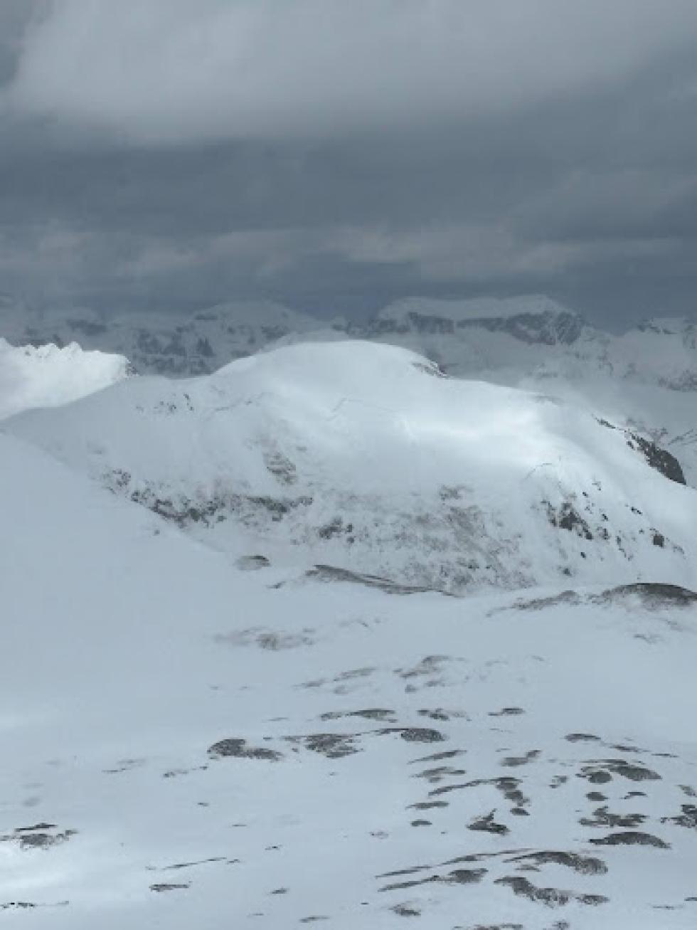
Elsewhere in the state, we saw drier weather to finish the month, which meant there was less of a slab on top of this newer weak layer. However, when it comes to a Colorado snowpack, it seems there is always a place still dealing with basal weak layers and depth hoar–even into April. The Mosquito Range, the eastern Sawatch Range, and eastern portions of the San Juan Mountains still had a relatively shallow and weak snowpack. The first two mentioned ranges received snow during the big mid-March upslope storm, so now the snowpack is composed of half slab and half basal facets, a dangerous combination. By late March, the eastern San Juan Mountains hadn’t received recent snow, leading to a mostly weak, but relatively safer snowpack. If these mountains see a big spring storm in April, watch out.
Close Calls and Accidents
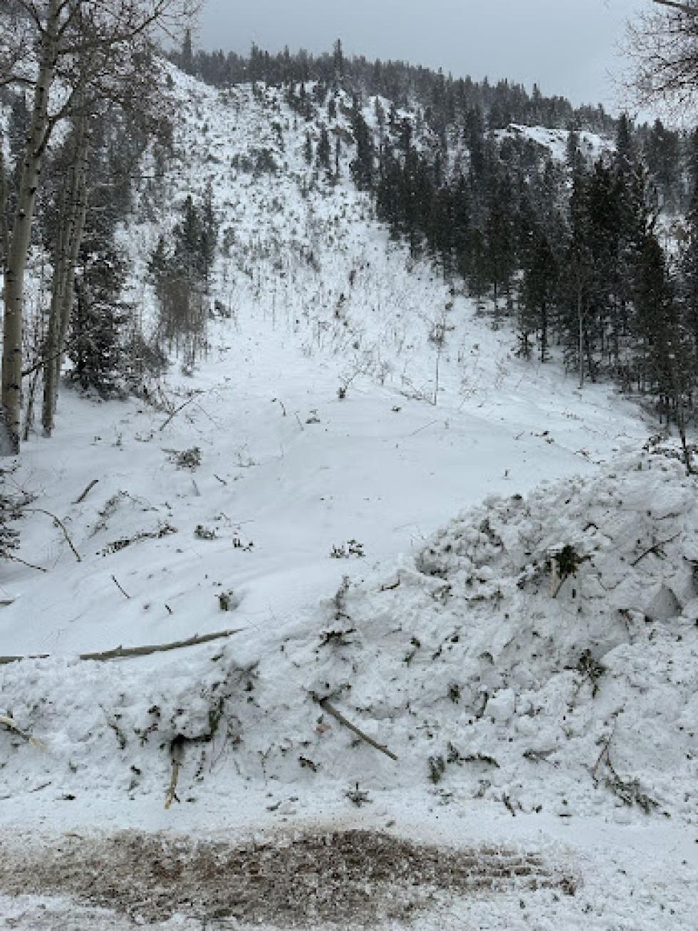
Two people were fully buried in two separate avalanches that thankfully ended in successful life-saving rescues. Both of these avalanches were related to significant snowfall loading a thinner-than-average snowpack. The first accident occurred on March 6 in Eyre Basin near the Upper Taylor River (click here for the full report). Heavy snow and strong winds overloaded the early February weak layer. A group of snowmobilers were crossing under a steep slope one at a time when the slope avalanched and fully buried one rider. The group sprang into action to recover the rider and provide life-supporting first aid. The rider was critically injured but survived.
The second full burial and recovery happened not far away on the Aspen side of Taylor Pass (click here for the field report). Two skiers were ascending a steep couloir when they triggered an avalanche that buried one of the skiers. Two members of the group were not in the couloir and were able to assist in the rapid recovery of the skier. The skier did not suffer any injuries.
There was a higher-than-usual number of people caught in avalanches during the last two weeks of March with an average of 2 people caught per day. Miraculously, the 32 people caught from March 17 to March 31 were not seriously injured. Most of these avalanches were relatively small but happened in steep, consequential terrain. Some of these avalanches occurred on a new weak layer buried on March 23.
Looking ahead
We ended March with a winterlike snowpack with dangerous avalanche issues, particularly in the Central Mountains. In the Northern and Southern Mountains, Persistent Slab avalanches became unlikely. This doesn’t mean there aren’t dry winter-like weak layers in the snowpack; there are just very few slopes in these regions where you can trigger an avalanche that breaks on a weak layer buried deep in the snowpack.
We are starting April with a big warm-up so wet avalanches are back on the menu, and they could be some of the largest we have seen this spring. In our always-warmer Southern Mountains, the snowpack is transitioning more quickly on many slopes to a spring-like snowpack. The springtime transition will gradually progress from south to north in the state, and also from southerly aspects to colder aspects in each region. Don’t jump the gun and get in trouble. The coverage in the mountains is looking phenomenal, and it should be a great spring season…when it arrives.